
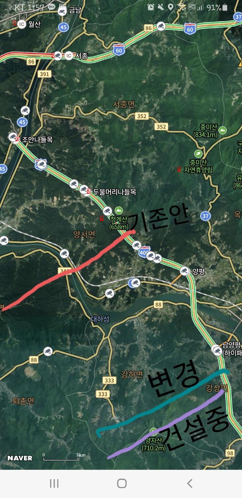
image text translation
(1)IC monthly calculation
(2)CLIC Seojong
(3)Joan Interchange
(4)a natural recreation forest
(5)Dumulmeori Interchange
(6)Cheonggye Mountain
The picture above is a rough outline
If you look at the bottom two lines
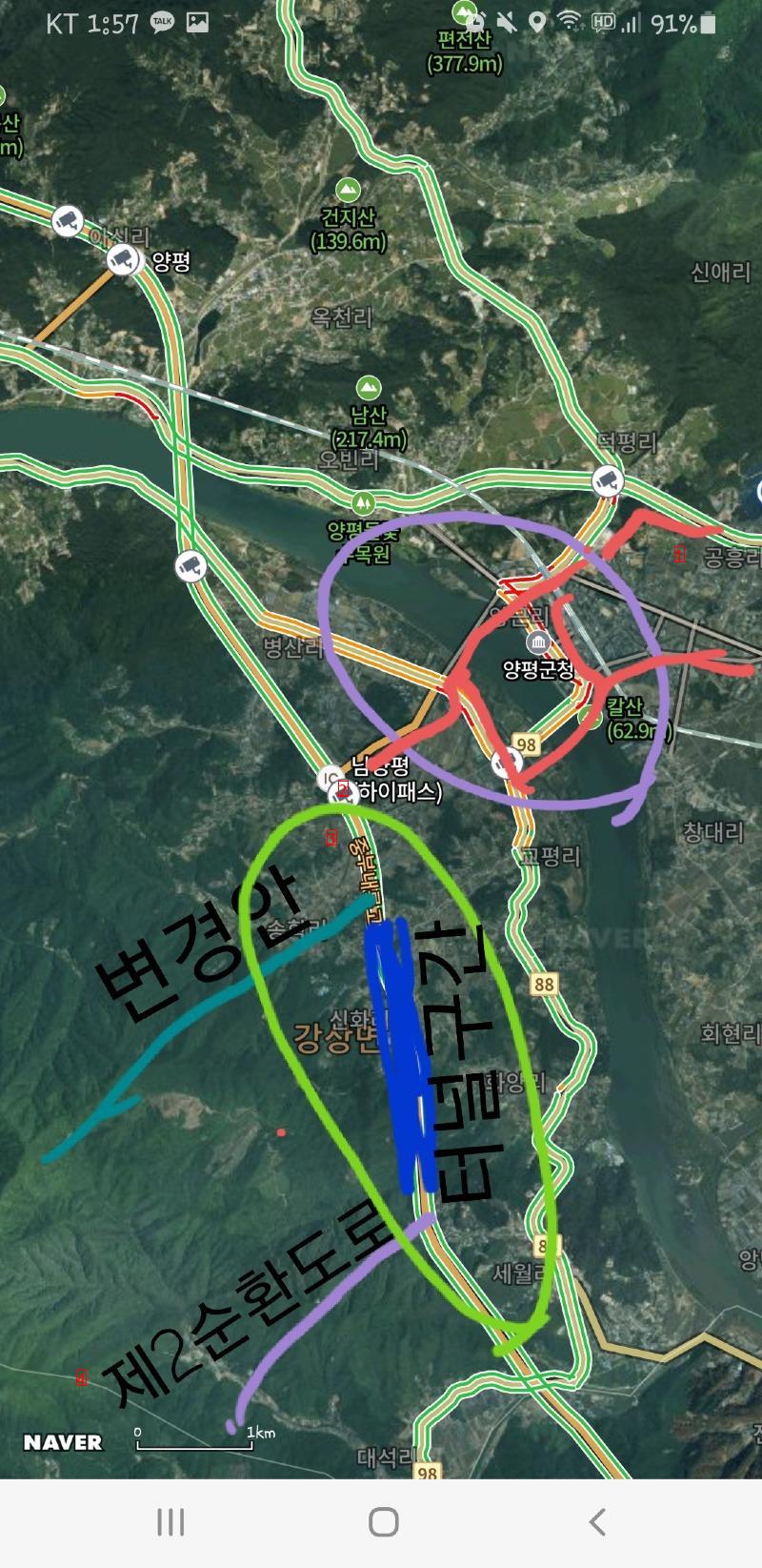
image text translation
(1)Gongheung-ri
(2)High pass
(3)= with the government down
(4)the Second Ring Road
If I were to explain what I see in the picture above
First of all, Yangpyeong Icheon section of the 2nd ring road, which is already under construction, is under construction in the area of the proposed change
However, if the change comes as planned, it will be a terrible construction environment that requires two branch points with a three-kilometer tunnel. Construction costs will increase that much because it will have to be the next branch in the existing tunnel
The red line in the picture is the route of traffic congestion, but if it is built according to the plan, that part will become more congested. The current Namyang Pyeongtolgate is a two-lane tollgate. A two-way access rest area is also under construction is underway