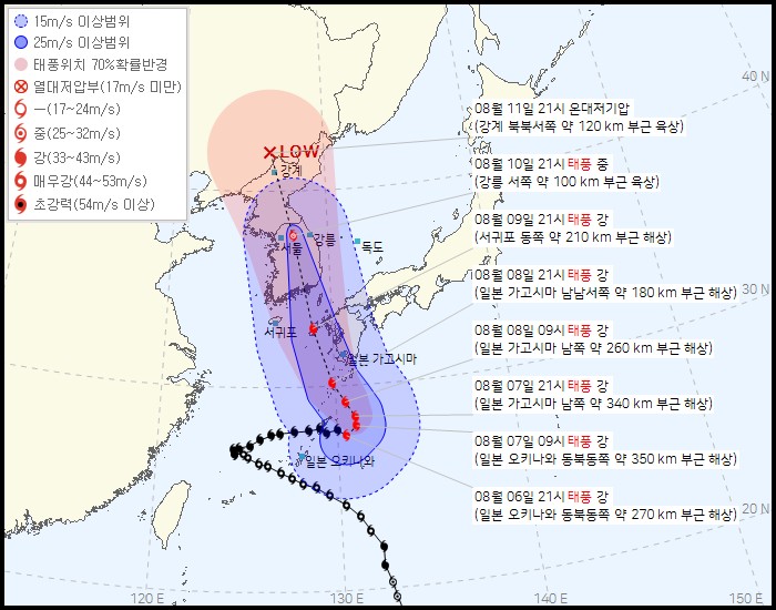
(1)15 ms unknown range
image text translation
(2)Range above 25ms
(3)Typhoon location 70 probability radius
(4)Tropical Depression Less than 17 ms
(5)August 11th at 21:00. Low pressure
(6)Land and land about 120km northwest of Ganggye
(7)Medium 25 to 32 ms
(8)Strong 33–43 ms
(9)October 10th, 21:00, during the typhoon
(10)6 Maeugang 44-53ms land about 100km west of Gangneung
(11)Super Strong 54ms Unknown
(12)August 9th 21:00 Typhoon Kang
(13)Sea about 210km east of Seogwipo
(14)October 8th, 21:00, Typhoon Kang
(15)30N sea, about 180km southwest of Kagoshima, Japan
(16)August 8 at 09:00 Typhoon Kang
(17)About 260 km south of Kagoshima, Japan
(18)Kagoshima, Japan
(19)August 07 at 21:00, Typhoon Kang
(20)About 340 km south of Kagoshima, Japan
(21)August 07 at 09:00, Typhoon Kang
(22)Japan Okinawa Japan Okinawa Sea about 350km northeast of Okinawa
(23)August 06 at 21:00, Typhoon Kang
(24)Sea about 270km northeast of Okinawa, Japan
The route becomes more westward and penetrates the center of the Korean Peninsula