See Source
httpspgr21comfreedom96395 

There was a flood not too long ago, and I saw an article saying that there is a flood hazard map overseas
Naturally, I found out that it’s fun to find out if there’s a map in Korea
Our country has 10 billion budget in 2001 produced a map by flood, but never released by 2020.
Government data can be obtained by requesting disclosure of information unless there is a special reason
Surprisingly, it wasn’t easy to get a request for disclosure
In 2020, KBS received a flood hazard map against the state through a request for information disclosure 
When KBS requested it,
I gave them 2,000 pages of PDF screenshots


httpsnewskbscokrspecialtamsaKfloodriskmapindexhtml
Anyways, KBS released it on the web in 2020 
httpsfloodmapgokrfldarafldaraListdo
After that, the Ministry of Environment didn’t know what to do
Publicly provide flood hazard maps in 2021
That’s what I’m going to do
If it ended here, I wouldn’t have written this
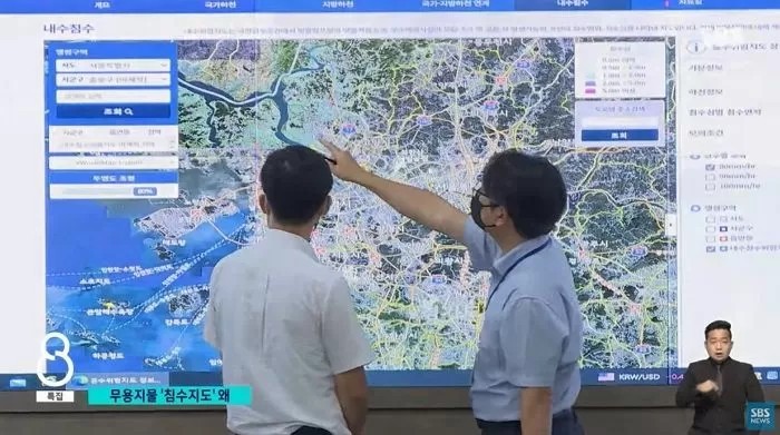
We restricted the zoom of the map because of traffic when the water went crazy in Seoul 
Real Image
I can’t zoom in
Seriously, that’s the maximum magnification
It’s not a level you can recognize Surprisingly, that’s the maximum zoom 
So every day, the economy analyzed the programming code of the site and found a part called maxZoom 10
This means that the maximum possible zoom of the map is limited to max 10
In addition, traces of maxZoom 19 being inserted and removed for a while were found right above the area, so it seems that it was intentional, not a mistake
Maeil Economy deleted the code and re-executed the site, and the map was expanded normally to identify areas vulnerable to flooding, including Gangnam Station and Sindorim Station in Seoul
According to the Ministry of Environment, the amount of access to the site has exploded due to heavy rain, limiting the ability to expand the map
On the 16th, an official from the Ministry of Environment said,
Re-normalize the function when flood damage subsides
That’s what I explained 
Japan is a hazard map, so I organized not only floods but earthquakes and landslides
We need to learn from this